


Countryside Voting District, Island County, Washington
About
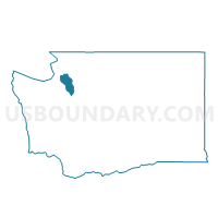
Outline

Summary
| Unique Area Identifier | 684453 |
| Name | Countryside Voting District |
| County | Island County |
| State | Washington |
| Area (square miles) | 7.26 |
| Land Area (square miles) | 6.53 |
| Water Area (square miles) | 0.73 |
| % of Land Area | 89.95 |
| % of Water Area | 10.05 |
| Latitude of the Internal Point | 48.32405110 |
| Longtitude of the Internal Point | -122.57554150 |
Maps


Graphs
Select a template below for downloading or customizing gragh for Countryside Voting District, Island County, Washington


Neighbors
Neighoring Voting District (by Name) Neighboring Voting District on the Map
- Dodge Valley Voting District, Skagit County, WA
- Fir Voting District, Skagit County, WA
- Highland Voting District, Island County, WA
- Oak Harbor 10 Voting District, Island County, WA
- Oak Harbor 9 Voting District, Island County, WA
- Polnell Voting District, Island County, WA
- Silver Lake Voting District, Island County, WA
Top 10 Neighboring County Subdivision (by Population) Neighboring County Subdivision on the Map
Top 10 Neighboring Place (by Population) Neighboring Place on the Map
Top 10 Neighboring Unified School District (by Population) Neighboring Unified School District on the Map
- Oak Harbor School District, WA (37,813)
- La Conner School District, WA (4,694)
- Conway School District, WA (3,102)
Top 10 Neighboring State Legislative District Lower Chamber (by Population) Neighboring State Legislative District Lower Chamber on the Map
Top 10 Neighboring State Legislative District Upper Chamber (by Population) Neighboring State Legislative District Upper Chamber on the Map
Top 10 Neighboring 111th Congressional District (by Population) Neighboring 111th Congressional District on the Map
Top 10 Neighboring Census Tract (by Population) Neighboring Census Tract on the Map
- Census Tract 9704, Island County, WA (6,131)
- Census Tract 9703, Island County, WA (4,989)
- Census Tract 9709, Island County, WA (4,801)
- Census Tract 9708, Island County, WA (2,706)
- Census Tract 9901, Skagit County, WA (0)